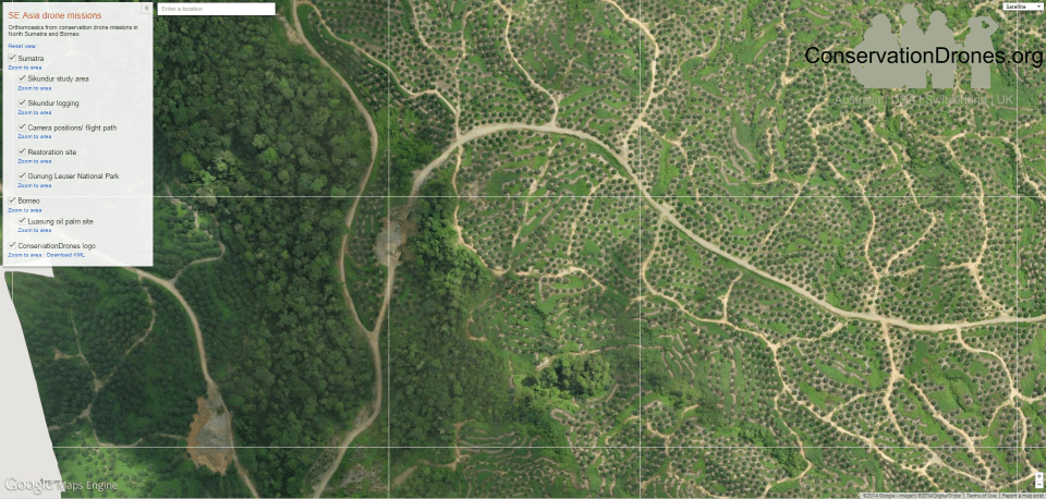
ConservationDrones Joining Forces with Google Earth Outreach
We are partnering with the fantastic folks at Google Maps Engine and Google Earth Engine to host and process data from our drone missions. This will make it easier for researchers and conservation practitioners to visualize our aerial images and mosaics, as well as to faciliate collaboration among colleagues. As a start we uploaded two mosaics from Sumatra. Exciting times! All mosaics were made with Pix4Dmapper.
This is awesome news, congratulations. Does this mean that your teams will all have access to the data from anywhere? I assume this is a sort of cloud repository for all your data, is that correct?
We are going to use drone imaging for an ecosystem service project in Kenya and Peru. How can we collaborate with Google Maps Engine and Google Earth Engine
Hi,
You can go to their website and then ask them if you can partner with them. They have a link on this website: https://earthengine.google.org/#intro
Best,
Serge