Oil Palm Landscape Mapped by Drone
Keeyen (our Asia team member) used his Skywalker 1900 equipped with an APM 2 and Canon S100 to map an oil palm estate owned by a friend. Keeyen’s Skywalker was able to track… Continue reading
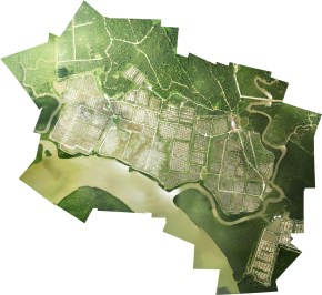
Keeyen (our Asia team member) used his Skywalker 1900 equipped with an APM 2 and Canon S100 to map an oil palm estate owned by a friend. Keeyen’s Skywalker was able to track… Continue reading
This is a 15-minute short film about Zuzana’s journey across parts of Madagascar with a drone, shining a spotlight on environmental and livelihood issues on the red island. It is a fascinating and… Continue reading
Madagascar Team Leader and Drone operator: Zuzana Burivalova (PhD candidate) Applied Ecology & Conservation Lab, ETH Zurich With support from: Dr Martin Bauert, ZOO Zurich Wildlife Conservation Society Madagascar Madagascar National Parks Tom… Continue reading
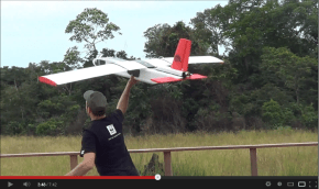
0:36 Mission planning 1:32 Takeoff 1:46 On-board cam takeoff 2:08 low flyby 2:53 Landing 3:47 Auto take off from platform 4:40 Spotting fires 5:40 Landing 6:17 Debriefing 6:47 Elephant pictures Video editing by Simon Wunderli (ResearchDrones.com)
2012 Annual Report for ConservationDrones.org Some excerpts: ConservationDrones.org had 49,000 views in 2012. The busiest day of the year was May 29th with 4,416 views. Our visitors came from 158 countries in all! Most visitors came… Continue reading
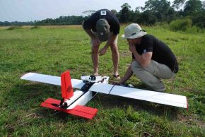
After traveling thousands of miles by air, a 16-h “road” trip and surviving 3 flat tires, Remo Peduzzi and Simon Wunderli from ResearchDrones personally brought our brand new WHITE Maja drones to conservation… Continue reading
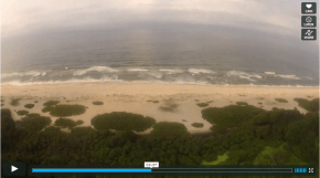
Sander van Andel (Max Planck Institute) flies Conservation Drone Maja in Loango National Park, Gabon, capturing turtle nests on the beach (first ever coastal mission!), forest buffaloes and chimpanzee nests (with a marker). Loangodrone flight overview… Continue reading
If you are using a GoPro HD camera, or any non-GPS enabled video camera, you can use a new web service, GPS4Sport.com, which allows for the synchronization of your APM log (in GPX format)… Continue reading
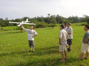
Video of conservation drone flight over Sepilok by ecologist, Chris Kettle. This is a Conservation Drone 1.0 (Bixler prototype) carrying a Canon IXUS 220 camera (video mode)
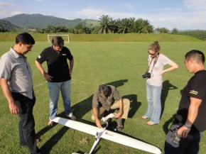
Updates from our Conservation Drones Asia Team (Keeyen and his son, and Wee Siong) who is helping ecologist Chris Kettle to conduct drone surveys over forests in Sepilok, Sabah (Borneo). (Link to Keeyen’s… Continue reading
3D forest model of a transect in Sumatra, Indonesia, based on aerial images acquired by Conservation Drones. Data processing by Dronemapper.com. Animation by Ervine Lin of ETH Future Cities Laboratory (futurecities.ethz.ch).
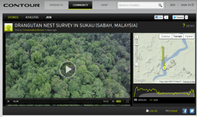
Collage of Orangutan Nests, a set on Flickr. This is a photo-collage of ~35 orangutan nests in SE Asian rain forests taken by cameras on board Conservation Drones. We are collaborating with colleagues… Continue reading
This is an 18-photo composite image of Zurich Zoo’s new elephant enclosure. Aerial photographs were taken by a camera on board an autonomous Conservation Drone 2.0 that was flying at a speed of… Continue reading
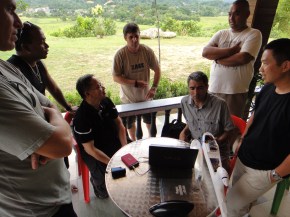
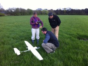
Training Ahimsa Campos-Arceiz and the MEME team from the University of Nottingham Malaysia Campus (Management & Ecology of Malaysian Elephants). Emma Stokes and Tony Lynam from WCS dropped by for a peek as… Continue reading

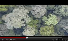
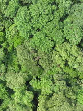
Two orangutan nests spotted by a Conservation Drone flying at 100m above ground.
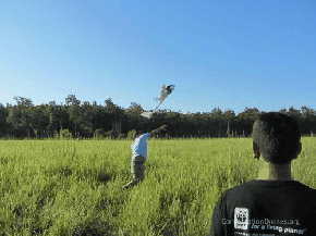
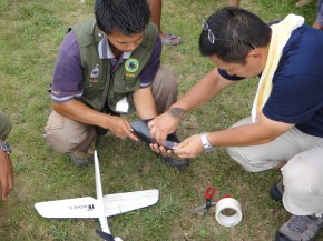
Serge and Lian Pin training Alex and Fiona from the Ugalla Primate Project to operate a Conservation Drone bound for Tanzania to survey chimps!
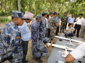
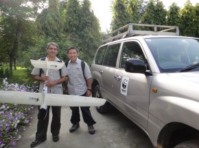
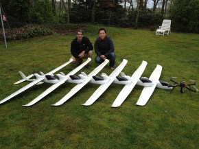
Serge and I spent the last few days in Asten, the Netherlands, building up our Conservation fleet. These will be going to the Jane Goodall Institute, University of Nottingham Malaysia, and WWF Nepal,… Continue reading
The mission of this website is to share our knowledge for building low-cost Conservation Drones to help conservation workers and researchers in developing countries do their jobs a lot more effectively and cost… Continue reading
Conservation Drones are inexpensive, autonomous and operator-friendly unmanned aerial vehicles for surveying and mapping forests and biodiversity. Non-technical operators can program each mission by defining waypoints along a flight path using an open-source… Continue reading